
The National Weather Service in Chanhassen has upgraded the Excessive Heat Watch to an Excessive Heat Warning for the Twin Cities area from 10 AM Wednesday morning through 9 PM Wednesday night.
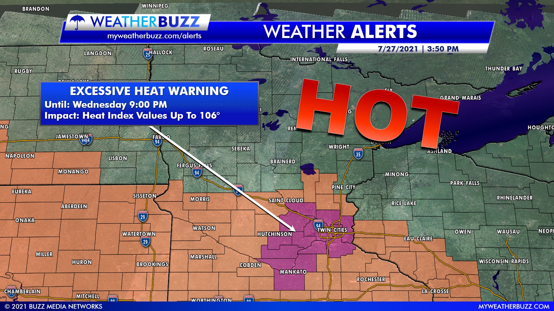
Heat Index values during this time could reach as high as 106° in the area included in the Excessive Heat Warning.
- WHAT: For the Excessive Heat Warning, dangerously hot conditions with heat index values up to 106° are expected. For the Heat Advisory, heat index values up to 103.
- WHEN: For the Excessive Heat Warning, from 10 AM to 9 PM CDT Wednesday. For the Heat Advisory, until 9 PM CDT this evening.
- IMPACTS: Potential for heat-related illnesses, particularly for those working or participating in outdoor activities.
Also issued were heat advisories for the following counties; Brown, Chippewa, Faribault, Kandiyohi, Lac Qui Parle, Martin, Meeker, Redwood, Renville, Rice, Swift, Waseca, Watonwan, Yellow Medicine, Benton, Chisago, Goodhue, Isanti, Kanabec, Mille Lacs, Pepin, Pierce, St. Croix, Dodge, Fillmore, Houston, Mower, Olmsted, Wabasha, Winona, Cottonwood, Jackson, Lincoln, Lyon, Murray, Nobles, Pipestone, Rock, Big Stone, and Traverse.
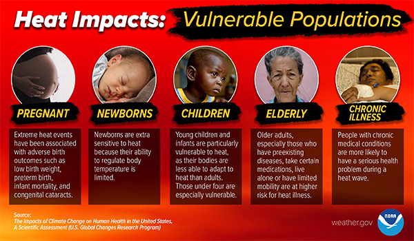
Drink plenty of fluids, stay in an air-conditioned room, stay out of the sun, and check up on relatives and neighbors. Young children and pets should never be left unattended in vehicles under any circumstances. Take extra precautions if you work or spend time outside. When possible, reschedule strenuous activities to early morning or evening. Know the signs and symptoms of heat exhaustion and heatstroke. Wear lightweight and loose-fitting clothing when possible. The Occupational Safety and Health Administration recommends scheduling frequent rest breaks in shaded or air-conditioned environments to reduce risk during outdoor work. Anyone overcome by heat should be moved to a cool and shaded location. Heatstroke is an emergency! Call 9 1 1.