
LAST UPDATED: 11/26/19 22:00
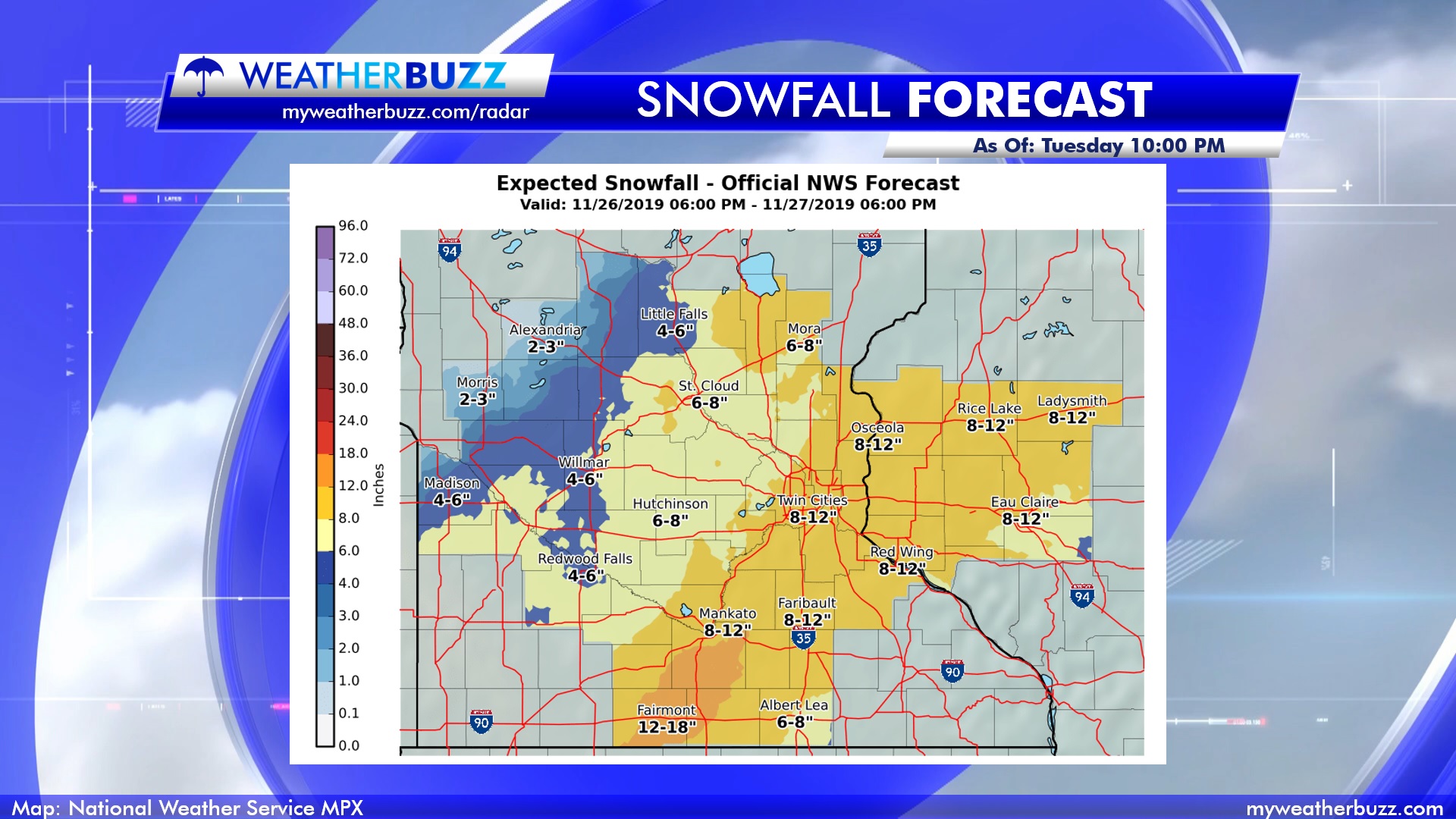
TOTALS: The Twin Cities and surrounding areas have been put under the gun for the potential of getting more than 6” of snow. Some portions of the viewing area even have the chance of getting more than a foot of snow. Off towards Alexandria and Brainerd, anywhere from 1” – 4” of snow is expected at the storm track. The map below shows the National Weather Service forecast for this snowfall event as of Tuesday night. Most of the area is expected to get at least 4” of snow as the lowest snowfall chance with higher totals expected.
ALERTS: The Winter Storm Warning was expanded to include most of the state. This Winter Storm Warning includes the entire Twin Cities metro area, Southern and southwestern Minnesota, and parts of Western Wisconsin.
STORM TIMELINE: Snowfall is expected to start and develop in the southwestern part of Minnesota towards 5 PM – 6 PM and spread into central Minnesota with an NE track through Tuesday night into Wednesday morning. Blowing snow is expected to develop late Tuesday night and last into Wednesday. The storm is expected to taper off towards the later morning on Wednesday. Winds will start to calm a little towards the afternoon.
HAZARDS: Some areas have the chance to pick up more than a foot of snow with blowing snow and gusty winds as well. Travel will be impacted by this event, creating a mess of a commute on Wednesday morning as well as individuals traveling for Thanksgiving.