PREVIEW: We are starting Saturday quietly before more active conditions move in tonight into Sunday. As the winds pick up on Saturday, blowing snow concerns will be prompted for everyone, with blizzard-like conditions tonight into Sunday for areas south of I-94.
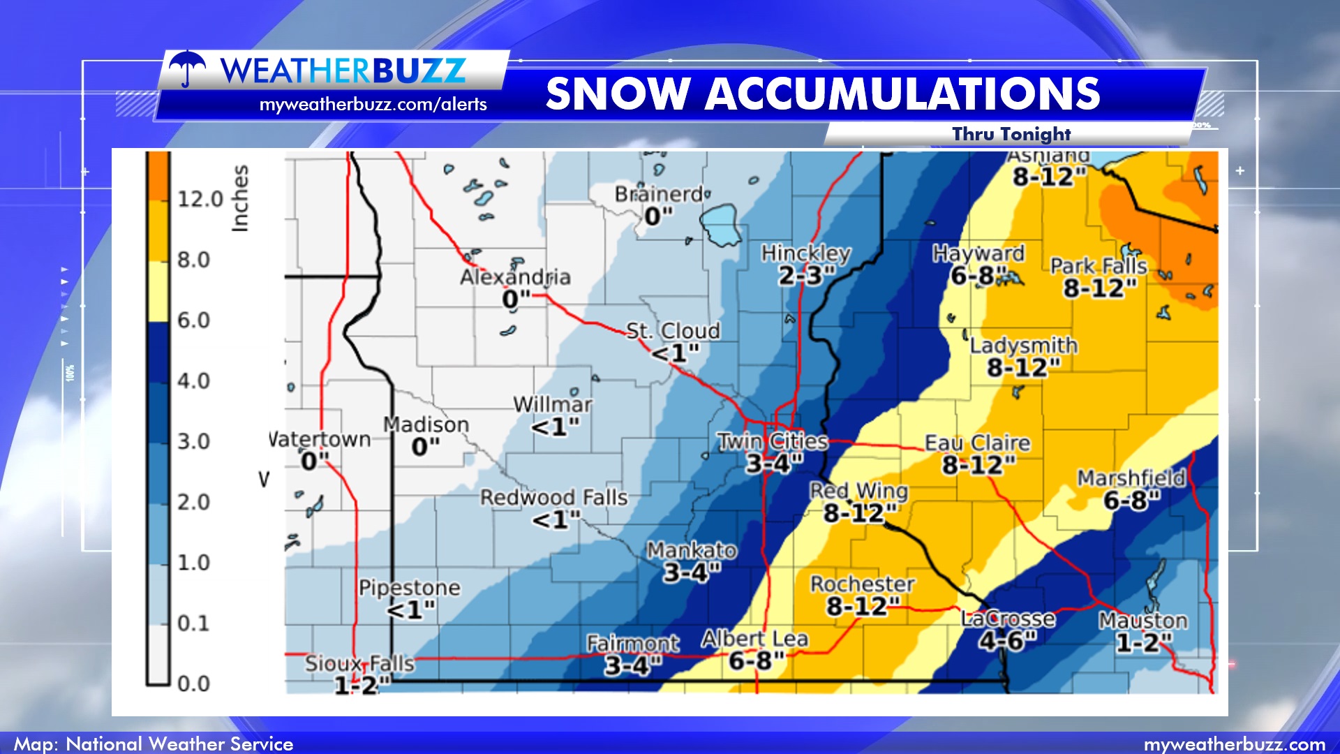
TOTALS: For this storm, a narrow band of heavy snow is expected in southeast Minnesota, with 8″ -12″ possible in some areas. The map below shows the snowfall totals expected Saturday evening through the overnight. Only a few inches are expected for the metro, with little amounts toward areas such as Willmar. Keep in mind, any snow that falls in the Blizzard Warning area will be wind-whipped and will create blizzard-like conditions with low to no visibility.

IMPACTED AREAS: Southeastern Minnesota to the western parts of Wisconsin will have heavier snow bands with this storm. South of I-94 in Minnesota will have 40-50 MPH with blowing snow concerns.
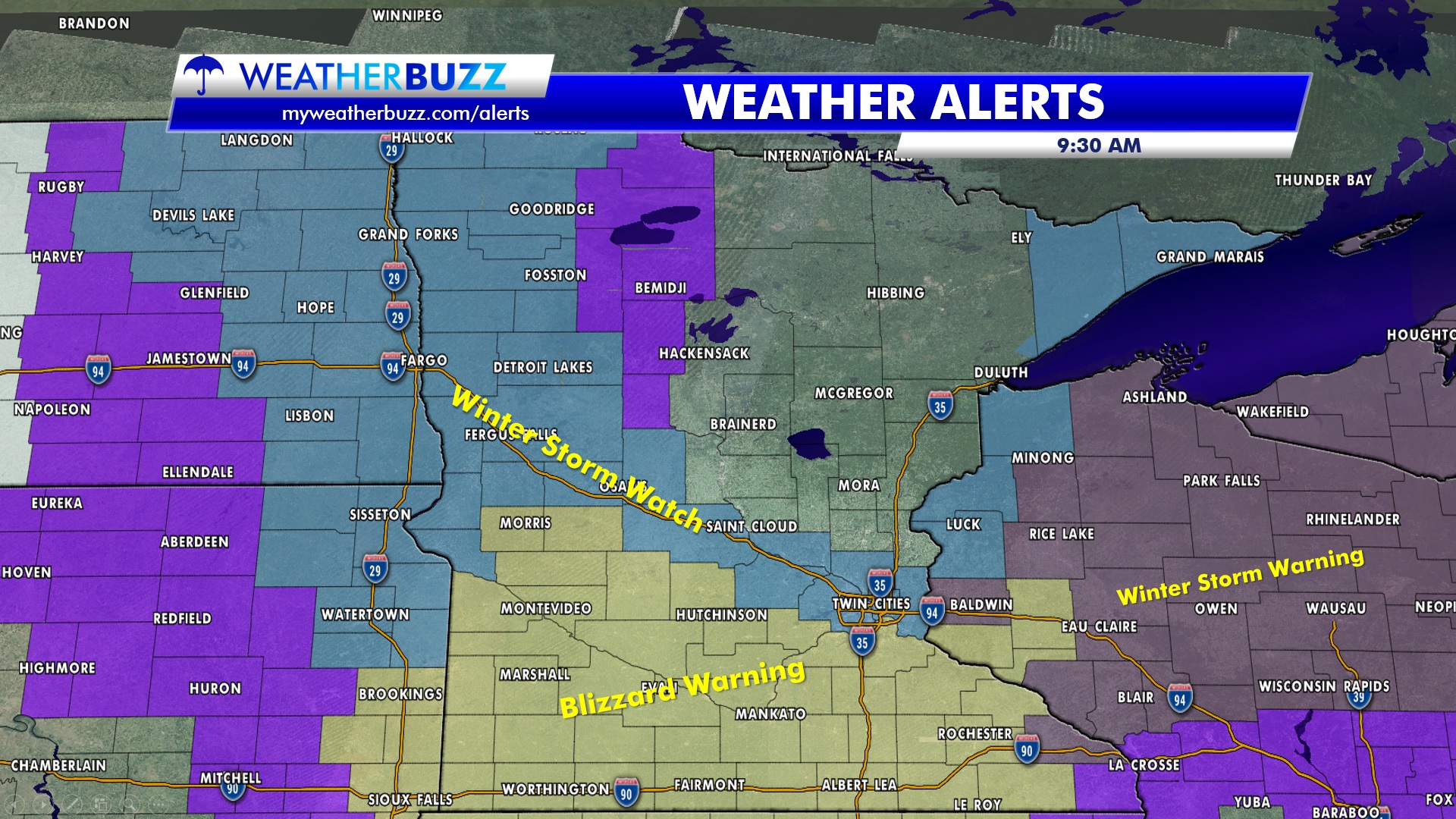
ALERTS: The map below shows the alerts that have been posted by the National Weather Service for this storm.

HAZARDS: Road closures are possible with this storm as the winds crank up later this evening, with whiteout conditions likely in the counties with the Blizzard Warning.
