
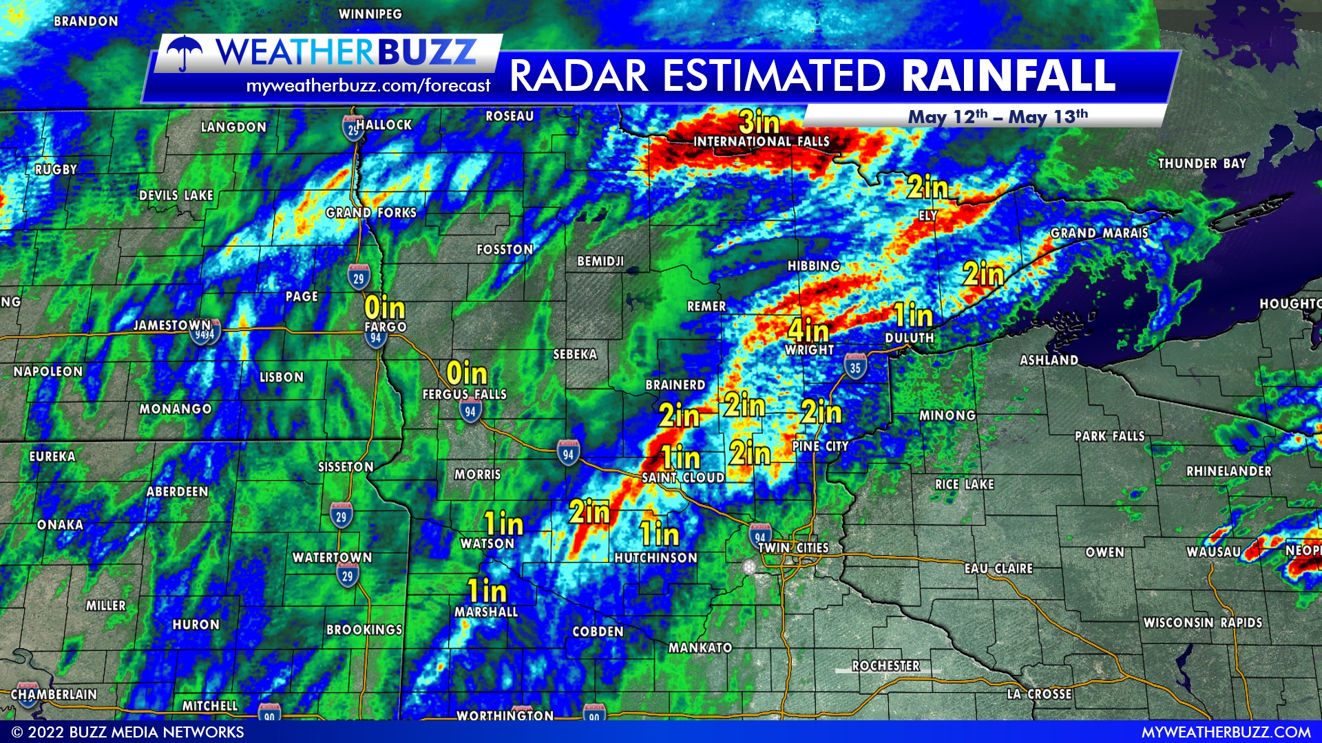
Heavy rainfall totals varied across the state on Thursday as another round of severe storms made their way across the area. The National Weather Service is calling this a rare event that moved across the eastern Dakotas and western Minnesota. These storms produced widespread wind damage and several reports of tornadoes as well.
Your backyard totals will vary from these maps as these are radar-estimated totals. The graphics below show the radar estimated totals across the local area and across the state.
Regional Rainfall
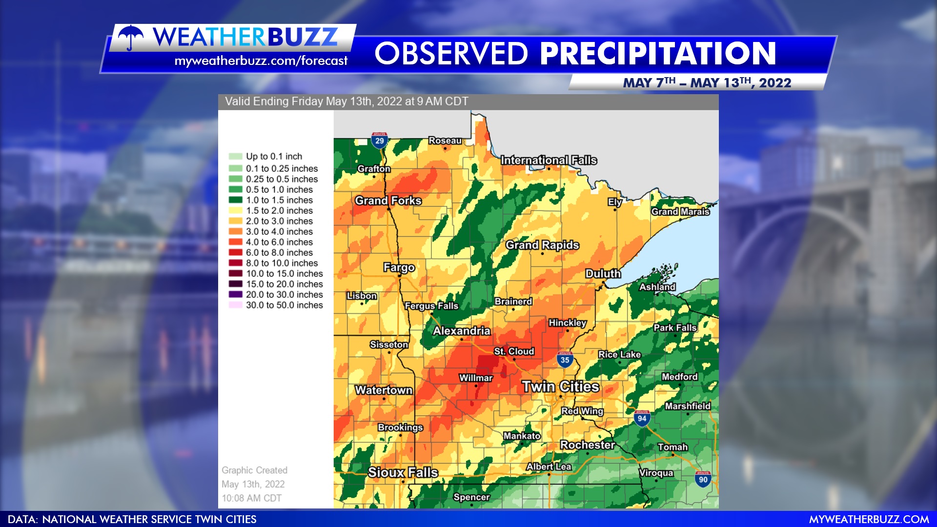
Weekly Rainfall Totals
The map below shows the observed precipitation totals across the state from May 7th through May 13th. A heavy band of rainfall can be seen across areas north of Willmar and by Saint Cloud.
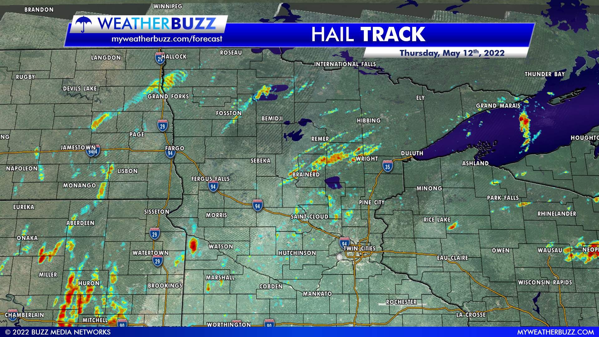
Hail Tracks
The map below shows radar estimated hail tracks on Thursday. A sizeable line from Brainerd up to Wright in northern Minnesota can be seen. According to the preliminary report from the National Weather Service, numerous large hail reports were confirmed by spotters and social media in this area.
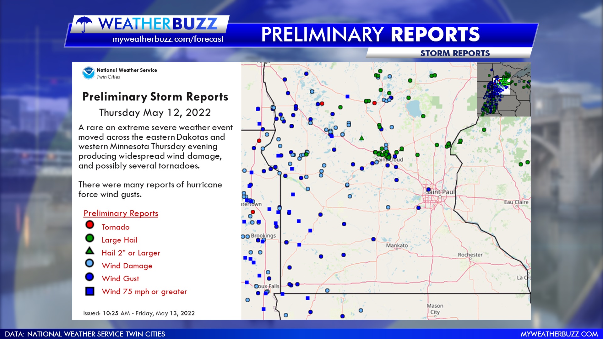
Storm Reports
The National Weather Service released their preliminary reports from Thursday’s severe storms earlier Friday morning. There were many reports of hurricane-force wind gusts across the area, with a few tornado reports in northern Minnesota. The graphic below shows the different reports from Thursday across the state.
Extended Forecasts
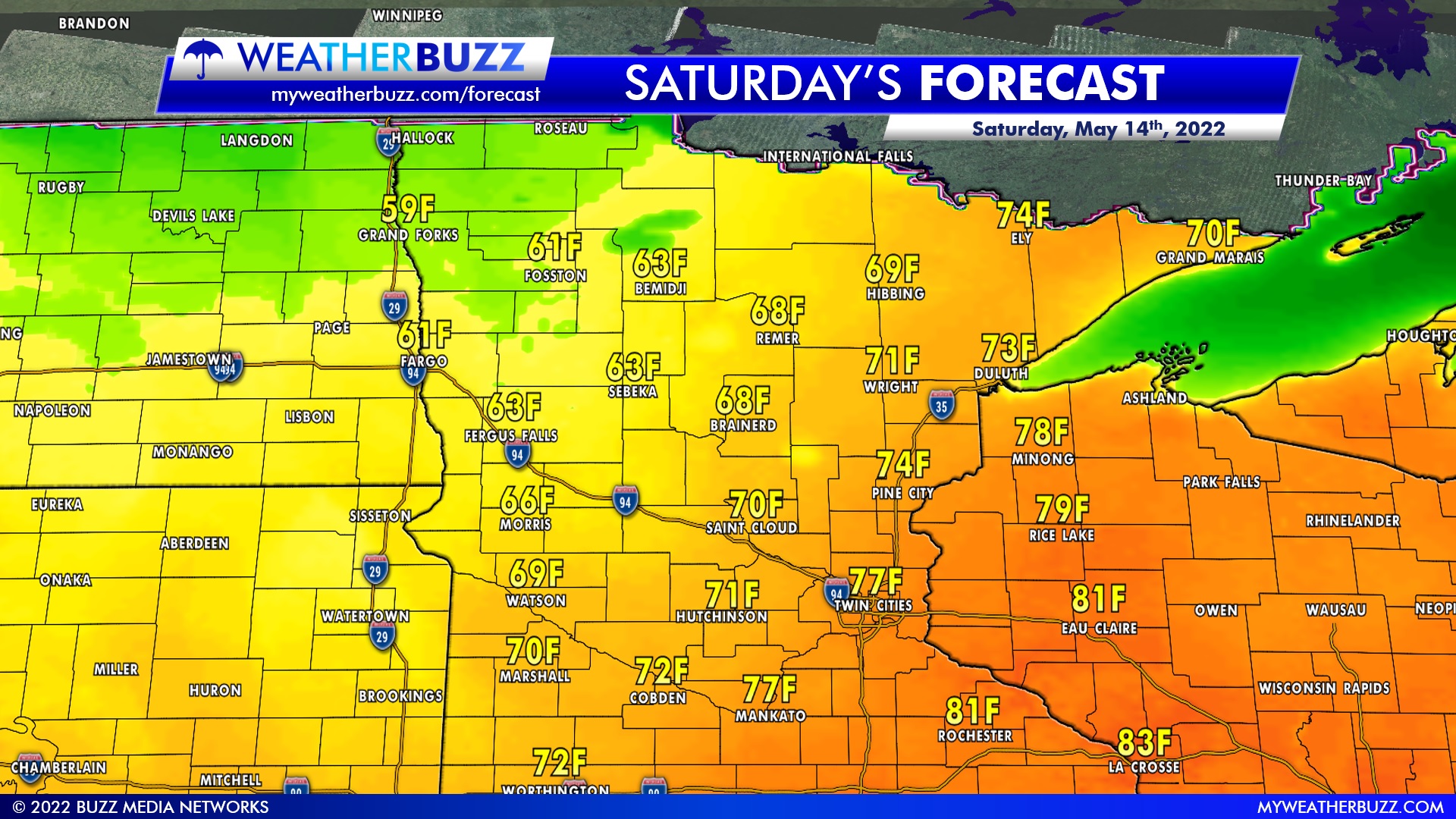
Regional Forecast
Cooler conditions west of the metro for Saturday, with low to mid-80s expected for southeastern Minnesota.
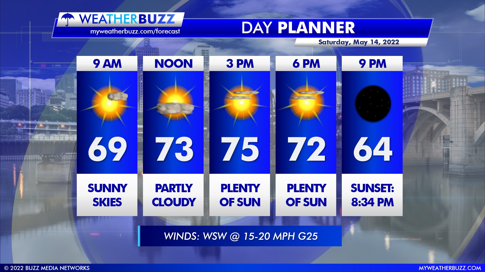
Day Planner
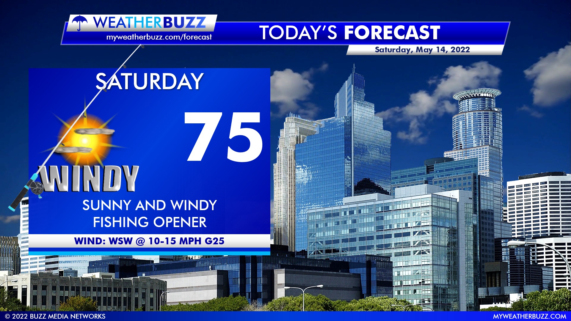
Plenty of sunshine is in store for Saturday with the mid-70s and a gusty breeze from the WSW @ 15-20 MPH, gusting near 25 MPH at times.
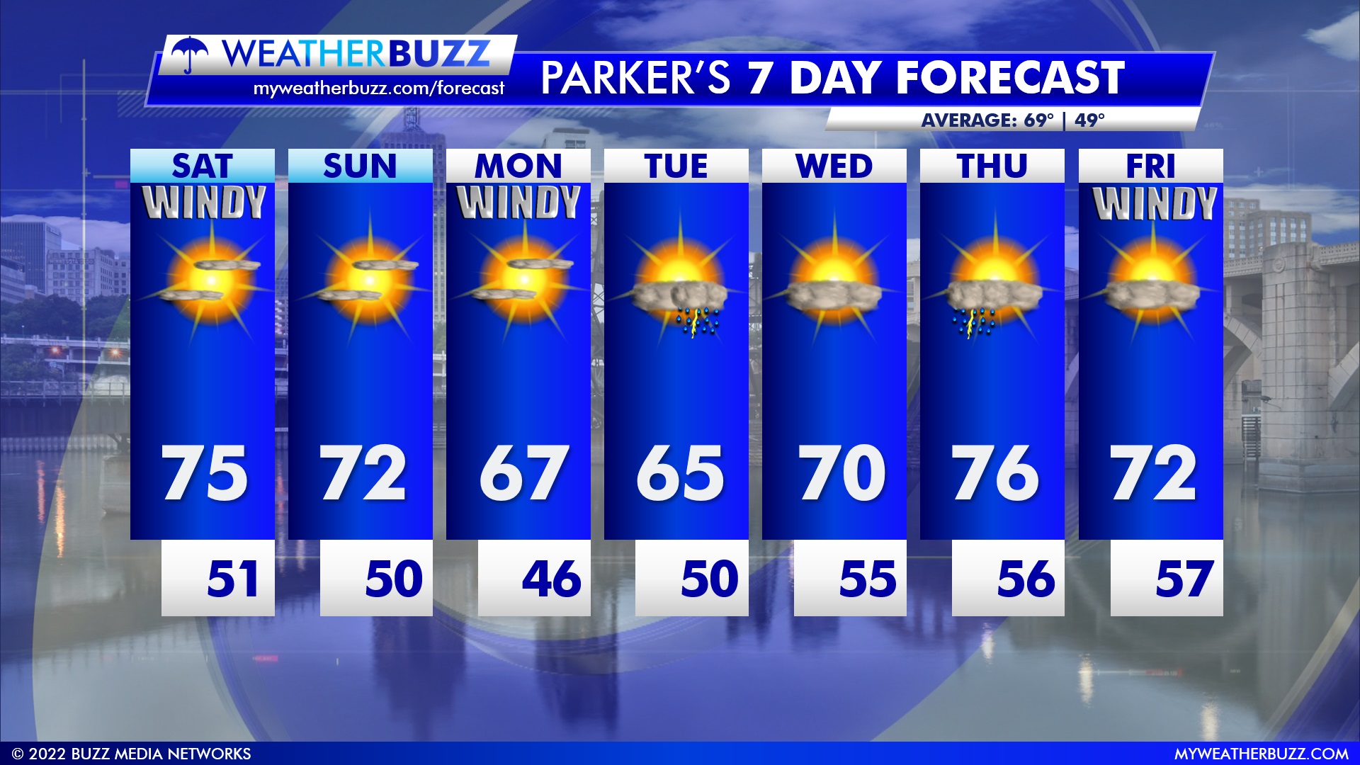
7 Day Forecast
We’re looking at a very dry and calm stretch of weather over the next few days before an isolated chance of a thunderstorm on Tuesday. Storms return again on Thursday before cooler and windier conditions on Friday. Our average high for this time of the year is in the upper 60s.
As a reminder, you can always get the latest forecasts on our website by clicking here.