
MONDAY QUICK FORECAST:
The forecast for Monday has us experiencing low 90s with partly cloudy skies. However, as the evening progresses, temperatures will dip into the mid-80s by 9 p.m. Winds, meanwhile, will stay calm from the ENE at 5-10 MPH. Additionally, a level 3 risk of severe weather is in place for portions of the state.
LOCAL FORECAST:
Your Monday will start warm, with patchy morning fog and temperatures hovering around 80°. As the afternoon approaches, temperatures will climb into the low 90s under partly cloudy skies. Moreover, scattered storms are expected later in the evening. It is important to note that some of these storms could become severe, especially since portions of central and southwestern Minnesota are under a level 3 risk for severe weather as of Sunday afternoon. When you factor in the dew points, it will feel more like 106°. As a reminder, you can always get the latest hourly forecast for your location right here on our website.

SEVERE OUTLOOK:
As of Sunday afternoon, the Storm Prediction Center has placed the Twin Cities metro, along with areas to the west and southwest, under an enhanced risk of severe weather for Monday. Furthermore, other parts of Minnesota, including Duluth, Fergus Falls, and Rochester, are under a slight risk of severe weather. For the latest severe weather outlooks, click here.

EXTENDED FORECAST:
Patchy fog will kick off Monday before the heat and humidity take over by the afternoon. Our feels-like temperature will reach nearly 106° at times. Towards the later evening and overnight, the area will see a chance of strong showers and thunderstorms. As of Sunday afternoon, the Twin Cities remain under a level three risk of severe weather. Isolated showers and thunderstorm activity may linger into Tuesday, accompanied by 80s and muggy conditions.
By Wednesday, patchy morning fog will give way to sunshine and low 80s. However, a chance of showers and thunderstorms enters the forecast for Thursday before the humidity and temperatures lower back down just in time for the weekend. Looking ahead to the Labor Day weekend, temperatures are expected to range from the mid to upper 70s with plenty of sunshine. The average temperatures for this time of the year are in the upper 70s for highs and low 60s for overnight lows.

FEELS LIKE FORECAST FOR MONDAY:
With our dew points forecasted to be in the mid to upper 70s, our projected temperature of 92° will feel like 106°. Consequently, if you find yourself needing to be outside on Monday, it’s crucial to ensure you have plenty of water and take frequent breaks from the heat!

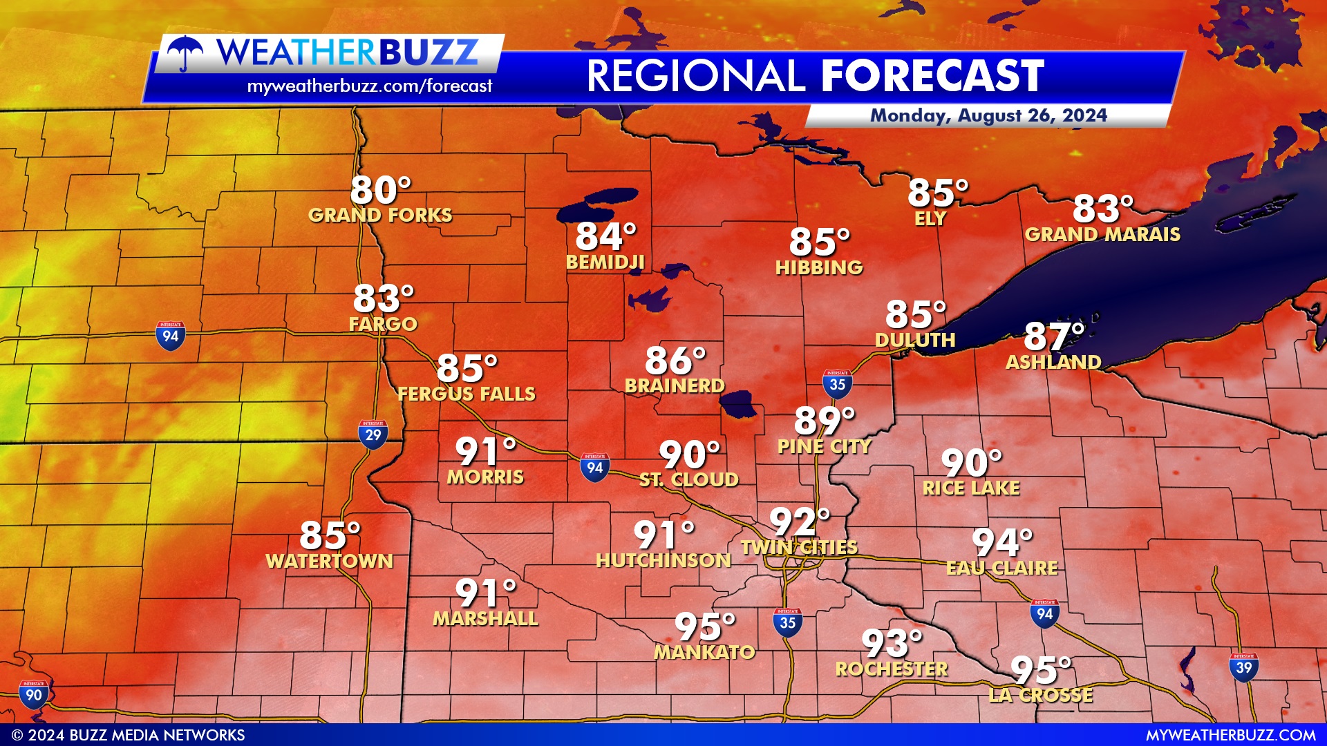
REGIONAL FORECAST FOR MONDAY:
Expect warm and toasty conditions across the region on Monday. For instance, temperatures in northern areas like Bemidji and Ely will peak in the mid-80s. In contrast, Minnesota’s southern and central parts will experience higher heat. Specifically, cities like St. Cloud and Morris will see highs around 90°, with Hutchinson and the Twin Cities pushing into the low 90s. Furthermore, it’s even hotter further south, where Mankato and La Crosse will climb into the mid-90s. Over in Fargo and Duluth, temperatures will be a bit cooler, reaching the low to mid-80s, but it will still feel warm throughout the day. Make sure to stay hydrated and take breaks in the shade if you’re spending time outdoors!